Freiberg mining town marks the start of major urban developments associated with the mining industry in the Ore Mountains. The historic town of Freiberg is today surrounded in a modern urban area and connected to the related Himmelfahrt Fundgrube (mine) by underground structures. The mining landscape stretches from north to south between Halsbrücke and the south of the town of Freiberg, from east to west between the Mulde River and the centre of the city of Freiberg. Its founding in 1168 dates directly back to the discovery of the first silver ore deposits in the farmer’s village Christiansdorf, which developed within a few decades to the most important and populated town of Saxony – called Freiberg (free mountain), because everyone was free to mine the silver ore here.
Due to the early intensive development of mining, Freiberg formed the centre for the sovereign mining administration authority and, from the 18th century, the centre for mining education and training. Buildings with diverse administrative functions were erected, including the town hall, the chief mining office (Oberbergamt) and the chief smelting office (Oberhüttenamt). The chief mining office of Saxony (Oberbergamt) is located in Freiberg to this very day in its historic building. The history of education, the history of the Mining Academy and the Freiberg Mining School is illustrated by various historical buildings such as the canon´s house and a range of buildings that make up the city campus of the TU Bergakademie Freiberg today.
Urban Layout
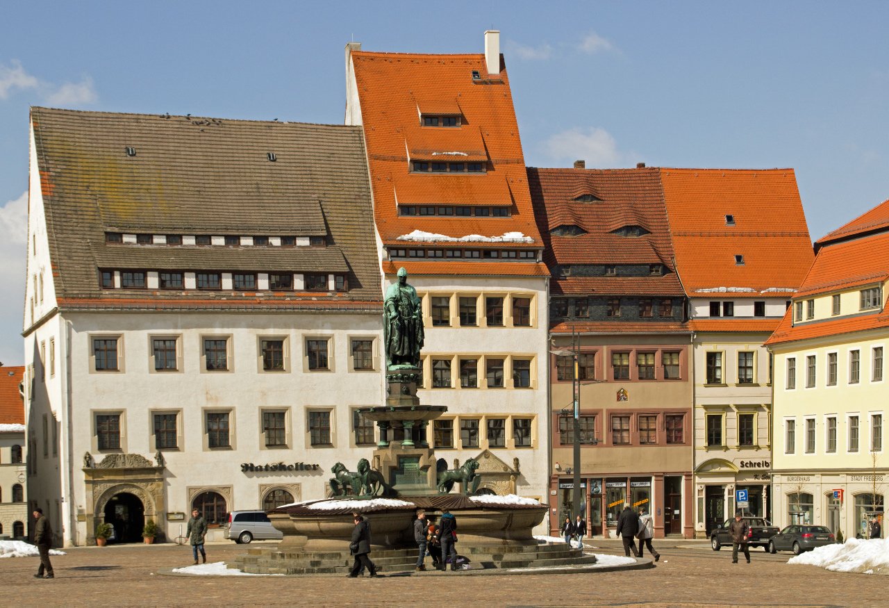
The new town developed since 1168 out of several primarily independent settlements (e.g. castle area, miner’s village, merchant quarter, farmer’s village) whose positions are still marked by the churches of the town. Around 1230 the whole settlement was encircled by a strongly fortified 2.7 km long town wall with primary 5 tower-gates, 41 wall-towers, 18 barbicans and 10 ponds. Until today around 700 metres and 8 towers of the original town wall survived. Whereas the urban layout of the earlier founded lower town of Freiberg was determined by the topography, the upper town, which was erected in the early 13th century, has a planned regular layout. Until today this urban layout with its historic urban road system embosses the historic town centre. Large parts of the medieval Anzüchte (underground drainage system) of the town are preserved.
Sacred and secular buildings
The wealth generated by mining is reflected in the architectural quality and artistry of many sacred and secular structures. Three of erstwhile four great medieval and in Renaissance time after the last great town fire of 1484 reconstructed town churches (St. Marien cathedral, Petri church, Nicolai church) are testifying the urban cores, the wealth of the town and with its interior (e.g. miners’ pulpit of St. Marien) their close connection to mining. Numerous of Freiberg’s buildings have a direct connection with mining and the trades and crafts performed in them (e.g. the granary, the mining storehouse, the warehouse). A great many of restored miners’ and burgher houses continue to serve as residential, administrative and business space today and document the remarkable development of the town due to the mining industry since the Middle Ages; respectively the 15th and 16th century following the town fire of 1484. The many decorative elements of the buildings express the close connection to mining and metallurgy (e.g. Schönlebe house). The cellar vaults of many houses are dating back to the 13th/14th century.
Administrative buildings
Freiberg was and still is the administrative centre of all mining activities in Saxony. The Saxon Oberbergamt (chief mining office) was established here in the 16th century, followed by the Saxon Oberhüttenamt (chief smelting office) in the early 17th century. Since 1679 until today the Saxon chief mining office is located in the same building (Kirchgasse 11, built 1530). Until 1859 the Saxon chief smelting office was located in the neighbouring building (Kirchgasse 13, built around 1530). Between 1859 and 1938 the office was located in a building (Nonnengasse 22) which afterwards became part of the town campus complex of the Freiberg Mining Academy. Further important administrative buildings are the town hall from the 15th century or the Alnpeck house which served as mint in the 16th century. The Freudenstein castle, which dates back to the site of the medieval margravial castle, was built in the second half of the 16th century. The old castle served as the residence of the margravial Vogt (reeve) and in the first half of the 16th century temporary as the residence of the Saxon duke. In 1784 the new castle was converted into a mining magazine and after 1814 into a granary. From 1980 to 1990 the castle was used by the local heritage administration and between 2005 and 2008 renovated and converted into the domicile of the famous mineral collection ‘Terra mineralia’ and of the ‘Bergarchiv’ (mining archive) Freiberg.
Freiberg Mining Academy and Mining School
The foundation and development of the Freiberg Mining Academy since 1765 as well as of the Freiberg Miners’ School (1778 to 1924) is closely intermeshed with the progress of mining and mining-related activities. Numerous domestic and foreign students educated at the Mining Academy over the past 250 years were employed worldwide. In the late 18th and early 19th century mining schools elsewhere in the world were founded following the example of the Freiberg Mining Academy. Various geo-scientific disciplines were established here. The elements indium and germanium together with numerous new minerals were discovered at this institution. Today, as a technical university, it is still responsible for the education of students from all over the world as specialists in mining and other disciplines.
Former shafts in the town of Freiberg
A small number of mines were also located within the territory of the town of Freiberg because the main ore lode (Hauptstollngang Stehender) and the Tiefer Fürstenstolln adit crossed the southeast part of the town. Within the historic town centre the presumably place of the first discovery of silver ore (Berggasse) and the former site of the Reicher Trost mine (Helmertplatz) are located. In the direct neighbourhood, but outside of the town wall, further mines like the Rote Grube mine and the Löfflerschacht mine mining on the Hauptstollngang Stehender (lode) or the Methusalem Fundgrube mine mining at the Thurmhof Gang lode were located. Former mines are also documented on the territory of the old part of the Donatsfriedhof cemetery directly in front of the Donatstor (town wall gate).


