The Eibenstock Mining Landscape is located in a forest area north of the town Eibenstock in the upper parts of the western Saxon Ore Mountains. It documents the extraction and processing of tin in the Western Ore Mountains from the 14th to the 19th century. The entire area is located in an extensive forest region, covering almost 1 km2 and is today one of the largest archaeological mining fields in the Western Ore Mountains. The property encompasses the tin ore lodes of the Grün (green) mine field with its archaeological relicts of placer fields, opencasts, underground structures and the Grüner Graben (ditch).
Tin placer mining, in the later Eibenstock mining district, was first mentioned in documents in 1378. Placer mining on a larger scale started in the early 17th century with the systematic creation of a number of placer sections or placer plants. Monuments to underground mining in this area are completely excavated lodes (Pressbaue) and shaft depressions. The characteristic landscape features include the placer fields, the opencast and the mining shaft depression fields as well as the remains of the central water management system of the Grüner Graben (ditch) and its tributary ditches.
In addition to placers and mining shaft depressions, the area also has a large number of preserved former water ditch structures. Finely washed sand plateaus or deposits can be found in several locations and indicate ‘bucker’ places to crush ores and adjoining ore dressing works. Scattered across the area are numerous places of former charcoal piles can be found. Further, relicts of an old trading route (so called Frühbußer Steig) between Saxony and Bohemia across the Ore Mountains as well as the old stone boundaries of a Lassraum (field of 31 to 16 m) are still visible in the landscape. A Lassraum is a small cultivation area leased by the landowner to the miners which lived within the mining area. The decline of tin mining in the Eibenstock mining district from about 1760 to 1890 was caused by the increasing depletion of ore deposits close to the surface, the fall of metal prices in the markets and the drop in tinplate production.
Schwarze Pinge shaft collapse
The Schwarze Pinge (shaft collapse) deserves a special mention. Located in the centre of the mining landscape, it is one of the largest and most famous shaft collapses caused by the collapse of underhand stopes. It has a length of about 200 m and runs from east to west. A series of smaller shaft collapses made up of dolines or ditch-shaped depressions run directly parallel next to the Schwarze Pinge in the north. The Schramm area is to the north of the Schwarze Pinge. The Schramm shaft collapses area has mainly small shaft collapse (Pinge) courses which go from east to west, consisting of dolines, waste heaps, digging holes and small shaft collapses in the forthcoming granite.
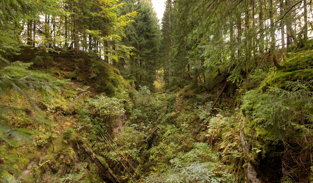
Grüner Seifen placer field
The placer mining field Grüner Seifen compromises a large area of waste heap rows and with canyon like valleys in between. The tops of the heaps are marking the former ground level. The valleys are the result of water supply by the Grüner Graben ditch used for washing out the ore. Also small block tin greisen deposits were mined in this area. Traces of this kind of mining are excavated canyon like depressions of more than 10 m depth.
Heiliger Geist and St. Bartolomäus shaft collapses areas
The shaft collapses areas (Pingenfelder) Heiliger Geist and St. Bartolomäus join the Grüner Seifen to the north and are characterised by elongated, cleft shaped shaft collapses, which run parallel to each other; in some areas only 5 m apart. The depth of the shaft collapses is up to 5 m. Further west, the shaft-collapse field merges into an extensively mined area, about 100 m in diameter and with a depth of 8 m. This area is also referred to as Große Pinge (shaft-collapse). The Ritter Georg Pinge (shaft collapse) to the north, however, exhibits again deep and partially circular dolines. The Löffler Pinge and the Hoffnung-Spat (lode) are situated in the south-west of the mining landscape. The Löffler Pinge range runs from east to west, with the main mining shaft collapse having a width of about 20 m, a length of 40 m and a depth of about 8 m. The shaft collapses are the result of the mining of vertical or inclined small ore veins by open cut mines or underhand stoping.
Grüner Graben ditch
The 8 km long Grüner Graben ditch was built between 1555 and 1558 and financed by the Saxon Elector. It supplied up to 10 placer fields and 22 stamp mills with water power.

