The archaeological site Hoher Forst Mining Landscape is located in a forest area on a ridge north of the Kleiner Hirschenstein (mountain), near Kirchberg, about 6 km north-west of the mining town Schneeberg in the Western Ore Mountains. With the decline of mining in the Freiberg region, the development of mining the upper Ore Mountains began. According to the settlement history of the region, the oldest mines were located exclusively at the foot of the mountain range in the eastern part of the Ore Mountains. Reasons were the proximity to agricultural areas, the existing transport infrastructure, river valleys with their water supply and draining function and, in higher reaches, the demand for wood as well as existing manorial protection.
The Hoher Forst Mining Landscape is one of the oldest and extraordinarily well-preserved mining landscapes of the Ore Mountains that displays a typical combination of early mining activity, a fortification and a mining settlement. The early settlement process was already regulated by rulers of the land as tangibly illustrated by the connection of these early settlements with castles. The extraction of silver, traced certainly back to 1306 but possibly dating before that, and the additional mining of argentiferous copper ores from the 15th century onwards left behind numerous shaft depressions over the ore lodes that remain clearly visible. The related mining town was abandoned as early as in middle of the 14th century due to the decline in mining.
In the second half of the 15th century, in addition to intensified development of the silver ore deposits at Schneeberg, the opening up of silver-bearing copper ore deposits also ensued in the Hoher Forst a short but unsuccessful second mining period. For this time a Bulgenkunst (chain pump) is recorded in this mining area (1472). Further minor mining activities were undertaken between 1793 and 1819 as well as between 1939 and 1945. At the end of 1817, the Martin-Römer-Tiefer-Erbstolln (adit) was closed down and the shafts were boarded up. In the course of time they collapsed, creating shaft depressions.
In the late 1930s, the later Martin-Römer mining claim in the Hoher Forst was descended as part of prospecting works for wolframite deposits. The prospecting works resulted in the discovery of tungsten ores in two places, whereupon mining was started. On 1st August 1945, operations were closed down. The name given to the Engländerstolln (adit) after World War II is probably attributable to the use of English prisoners-of-war in its expansion.
The area features over 160 typically funnel-shaped shaft depressions, mostly grouped in two parallel rows, as well as structures that indicate a medieval motte and bailey castle and fortified settlement. The rows of shaft depressions are located on the eastern and western side below the mountain crest that levels off in a northerly direction, and depict the course and the position of the main ore lodes. The centre of Fürstenberg, a mining town that has fallen into decay, features an enclosed area, 100 x 90 m, on the south-western upward slope. This heavily fissured area features three large shaft collapses located above the Martin Römer adit as well as several smaller shaft collapses and elevated areas resembling waste heaps.
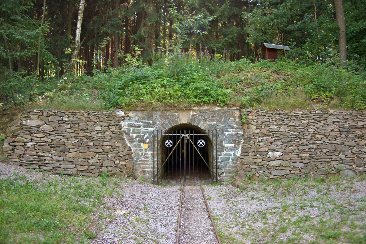
In the north-western corner of the area, there is another separately enclosed area, 15 x 20 m, in which evidence of a small medieval castle was discovered as a result of archaeological excavations of the remains of a sunk structure (cistern) as well as ceramic fragments. In the course of further excavations, one of probably a number of mine buildings was also found outside the wall enclosure. The mouth of the Martin Römer adit is situated in the south-western part of the mining landscape. Constructed in 1807, it is 1 m high and approx. 0.60 m wide, and the first part (for a length of approx. 8.5 m) is lined with granite blocks. The mouth of the adit known as the Engländerstolln (adit) is located in the north-eastern part of the mining landscape.


